Without going out of the gate, one is aware of the world
("Tao Te Ching", classical text attributed to Lao Tzu, around 600 BC)
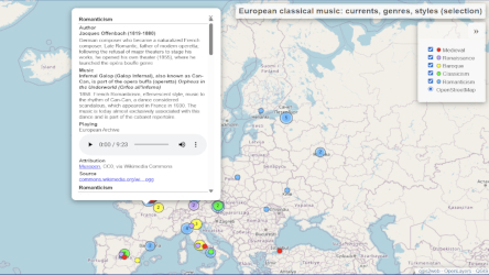
Interactive Thematic Maps
Interactive thematic maps overlay cultural or demographic data and multimedia elements on top of a geographic base layer. The user explores the content by: Layer management: Selectively show or hide layers as needed. Accessing additional information: when activating symbols by clicking or tapping. Dynamic navigation: Detailed exploration through zoom, pan and scroll functions.
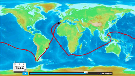
Animated Thematic Maps
Animated thematic maps transform static representations into dynamic narratives, adding the dimension of time. They synthesize complex topics into short videos, using: Dynamism: Marking places, indicating routes and visualizing changes in real time. Synchronized multimedia: Audio explanations, sound effects and video sequences correlated with the image. Synthesis: Exposing the essentials for quick, clear understanding.